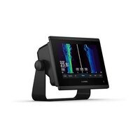
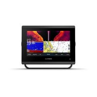
Garmin GPSMAP® 743xsv
|
|
|
Specifications
|
Model |
010-02365-03
|
Category Name |
Boat
|
Year |
2024
|
|
Sale Type |
New
|
Manufacturer |
Garmin
|
Odometer |
km
|
|
Price |
Contact for price CAD
|
|
|
|
|
Description
|
GET A SHARPER VIEW FROM YOUR CONNECTED HELM
With its sleek design, powerful processing and upgraded IPS display, this advanced 7”, 9” or 12” chartplotter integrates seamlessly into your Garmin marine system.
|
- Easily integrate with more engines.
- Connect to compatible third-party devices with OneHelm™ digital switching.
- Easily build your marine system using the best of network connectivity.
- Navigate any waters with preloaded mapping and coastal charts.
- See below your boat with built-in sonar capabilities.
- Manage your marine experience from nearly anywhere1.
|
|
|
|
SEE THE WORLD BELOW.
|
See_the_world_below.
|
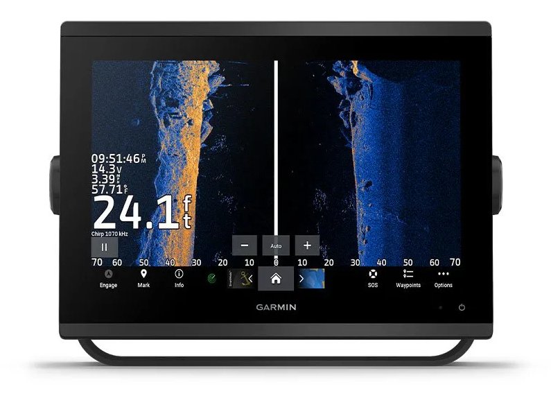 ULTRA HIGH-DEFINITION SCANNING SONAR ULTRA HIGH-DEFINITION SCANNING SONAR
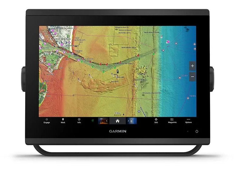
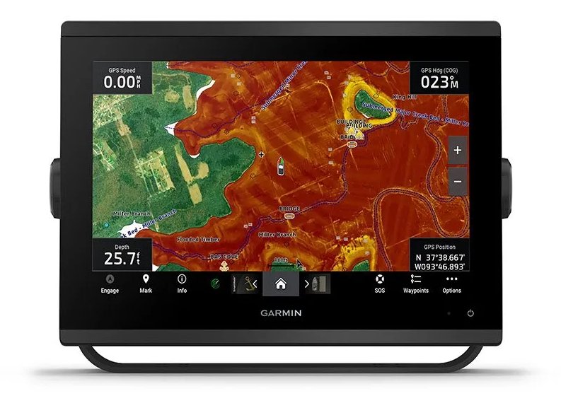
Get built-in Ultra High-Definition SideVü and ClearVü scanning sonars with vivid, high-contrast color palettes to help distinguish fish from structure. GPSMAP® X3 series also supports 1 kW CHIRP traditional sonar capabilities.
|
|
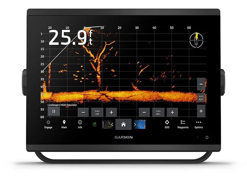 PANOPTIX™ SONAR SUPPORT PANOPTIX™ SONAR SUPPORT
Pair with Panoptix or LiveScope™ easy-to-interpret live sonar (transducer required, sold separately) to see all around your boat in real time.
|
|
|
MADE FOR YOUR HELM.
|
Made_for_your_helm.
|
 FASTER, SHARPER, SMARTER FASTER, SHARPER, SMARTER
With its added processing power and new slimline design featuring edge-to-edge glass and a smaller unit footprint, it’s easy to retrofit this plotter in a wider range of dash configurations.
|
|
 IMPROVED DISPLAY OPTICS IMPROVED DISPLAY OPTICS
New higher-resolution IPS displays for 9” and 12” plotters offer improved sunlight readability and visibility from any angle, with 50% more pixels than previous-generation 9” GPSMAP devices.
|
|
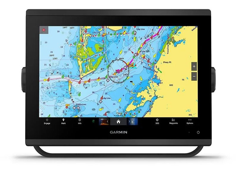
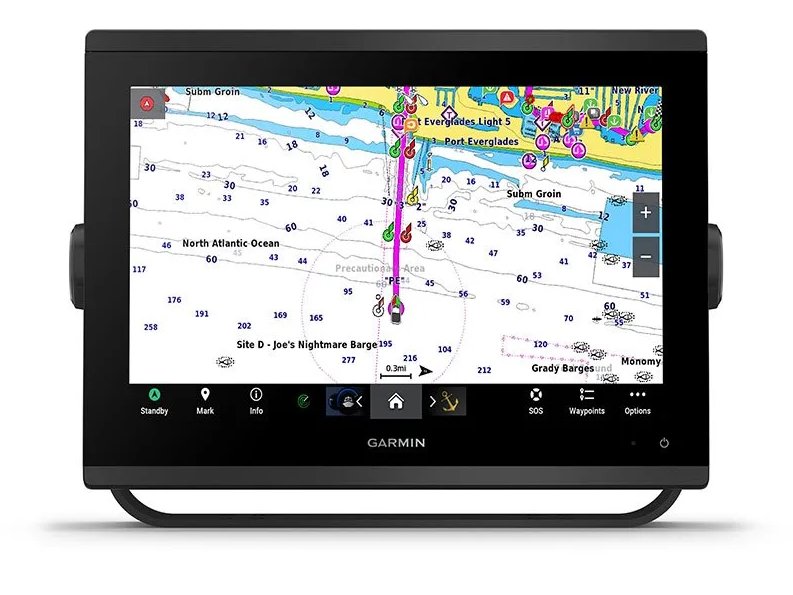
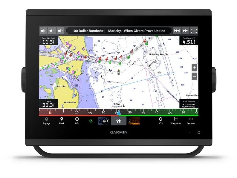 PRELOADED MAPPING PRELOADED MAPPING
Experience unparalleled coverage and detail with preloaded BlueChart® g3 coastal charts and LakeVü g3 inland maps featuring integrated Garmin and Navionics® content and Auto Guidance3 technology.
|
|
 OPTIONAL CHARTS AND MAPS OPTIONAL CHARTS AND MAPS
Bring a fresh new look and feel to your chartplotter with optional Garmin Navionics+™ or premium Garmin Navionics Vision+™ cartography featuring integrated coastal/inland content, access to daily updates, Auto Guidance+™ technology2 and more.
|
|
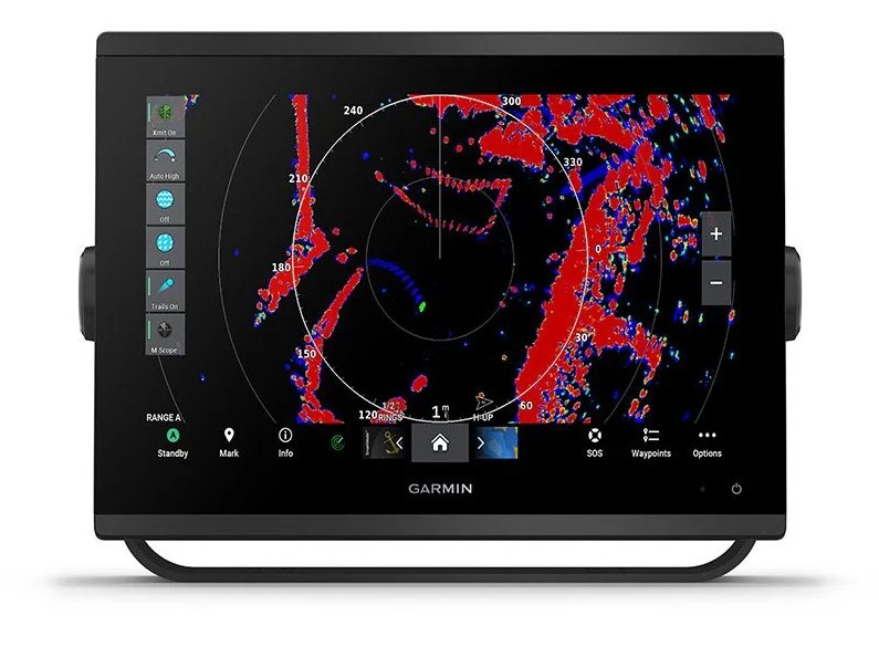 OPTIONAL RADAR BUNDLE OPTIONAL RADAR BUNDLE
To help you avoid weather and traffic on the water, the compact 4 kW GMR™ 18 HD+ dome radar is available as a bundled option with your GPSMAP chartplotter/sonar package.
|
|
|
SAIL AND NAVIGATE WITH EASE.
|
Sail_and_navigate_with_ease.
|
 GARMIN SAILASSIST™ SAILING FEATURES GARMIN SAILASSIST™ SAILING FEATURES
View laylines, race start line guidance, enhanced wind rose, heading and course-over-ground lines, true wind data fields and tide/current/time slider, wind angle, set and drift, wind speed, polars and more3.
|
|
 OPTIONAL PREMIUM NAVIGATION FEATURES OPTIONAL PREMIUM NAVIGATION FEATURES
These optional charts offer the best of Garmin and Navionics® data, Auto Guidance3 technology and other premium navigation features.
|
|
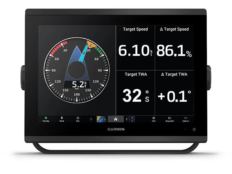 SAILING POLARS SAILING POLARS
Use the polar table to see key data, including how fast you should go at a certain wind angle and speed — so you know whether you need to adjust sail trim.
|
|
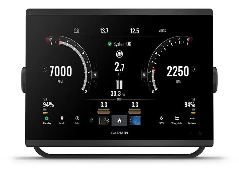
 GARMIN MARINE NETWORK GARMIN MARINE NETWORK
If you have multiple compatible Garmin devices on your boat, you can share information — such as maps, user data, radar and IP camera video — among them.
|
|
 NMEA 2000® AND NMEA 0183 NETWORKS NMEA 2000® AND NMEA 0183 NETWORKS
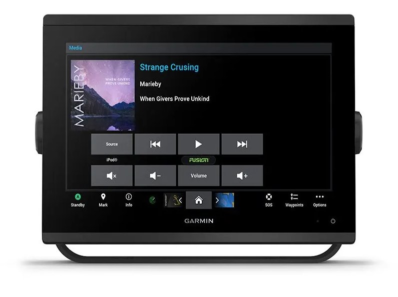
Connect to compatible autopilots, digital switching, weather, Fusion-Link™ audio system, media, VHF, AIS and more from one screen.
|
|
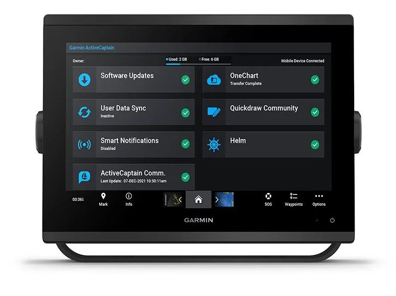 ACTIVECAPTAIN® APP ACTIVECAPTAIN® APP
Built-in Wi-Fi® connectivity pairs with the free all-in-one mobile app for access to the OneChart™ feature, smart notifications, software updates, Helm, Garmin Quickdraw™ Community data and more4.
|
|
 INTEGRATED ANT® TECHNOLOGY INTEGRATED ANT® TECHNOLOGY
Connect with some of your favorite devices, such as quatix® marine watches, gWind™ Wireless 2 transducers, GNX™ Wind marine instruments and wireless remote controls.
|
|
 J1939 CONNECTIVITY J1939 CONNECTIVITY
Now you can connect your chartplotter to different kinds of engines, including select Yamaha engines.
|
|
 ONEHELM FEATURE ONEHELM FEATURE
This feature brings together all the operations and capabilities of select third-party devices, such as EmpirBus™ digital switching, on one screen.
|
|
|
GENERAL
|
General
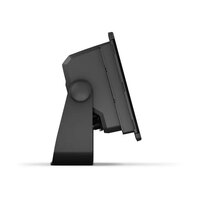
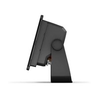
| Dimension |
7.6" x 5.5" x 2.9" (19.2 x 14.0 x 7.4 cm) |
| Touchscreen |
|
| Input |
Touchscreen |
| Display Size |
6.1" x 3.5"; 7.0" diagonal (15.4 x 9.1 cm; 17.8 cm diagonal) |
| Display Resolution |
1024 x 600 pixels |
| Display Type |
WSVGA |
| Weight |
2.8 lbs (1.3 kg)
|
| Waterproof |
IPX7
|
| Mounting Options |
Bail, flush or flat (Garmin does not offer any hardware or accessories for a flat-mount installation. Professional tools and knowledge is required.) |
|
|
MAPS & MEMORY
|
Maps_&_Memory
| Accepts Data Cards |
2 microSD cards (back of unit)
|
| Waypoints |
5000
|
| Track points |
50,000 |
| Tracks |
50 saved tracks |
| Navigation Routes |
100 |
|
|
SENSORS
|
GPS
GLONASS
Galileo
Receiver
10 Hz
Supports_WAAS
NMEA_0183_Compatible
NMEA_2000_Compatible
Has_built-in_receiver
|
|
ELECTRICAL FEATURES
|
Electrical_Features
| Power Input |
10 to 32 Vdc |
| Typical current draw at 12 Vdc |
1.18 A |
| Maximum current draw at 12 Vdc |
2.96 A |
| Maximum power usage at 10 Vdc |
35.9W |
|
|
BUILT-IN MAPS
|
Tide_tables
LakeVu_(inland)
BlueChart_(coastal)
Built-in_Auto_Guidance
|
|
OPTIONAL MAP SUPPORT
|
TOPO
LakeVü_g3
LakeVü_g3_Ultra
Standard_Mapping
Garmin_Navionics+™
Raster_chart_support
Garmin_Quickdraw_Contours
Garmin_Navionics_Vision+™
|
|
CHARTPLOTTER FEATURES
|
AIS
DSC
OneHelm_support
Sailing_Features
Spoken_audio_alerts
Smart_Mode_Compatible
ActiveCaptain®_compatible
Wireless_Remote_Compatible
GCV_Black_Box_Sonar_Support
GSD_Black_Box_Sonar_Support
Supports_Fusion-Link™_compatible_radios
GRID_(Garmin_Remote_Input_Device)_compatible
|
|
SONAR FEATURES & SPECIFICATIONS
|
Sonar_Features_&_Specifications
| Power output |
1 kW |
| Traditional sonar (dual frequency/beam) |
built-in (single channel CHIRP, 70/83/200 kHz, L, M, H CHIRP) |
| ClearVü |
built-in 260/455/800/1000/1200 kHz |
| SideVü |
built-in 260/455/800/1000/1200 kHz |
|
|
CONNECTIONS
|
Connections
| NMEA 2000 ports |
1 |
| Connections NMEA0183 Input Ports |
1
|
| NMEA 0183 input (Tx) ports |
1 |
| Video input ports |
1 (BNC composite)
|
| J1939 ports |
1 |
| Garmin Marine Network Ports |
1
|
| 12-pin transducer ports |
1 |
|
|
IN THE BOX
|
In_the_Box
- GPSMAP 743xsv chartplotter
- microSD™ card preinstalled
- Power cable
- NMEA 2000® T-connector
- NMEA 2000 drop cable (2 meters)
- 8-pin transducer to 12-pin sounder adapter cable
- Bail mount kit with knobs
- Flush mount kit with gasket
- Protective cover
- Trim piece snap covers
- Documentation
|
|
With 18 HD+ Radar
Above contents plus:
- GMR 18 HD+ radome
- Mounting hardware kit
- Power cable (15 m)
- Network cable (15 m)
- Installation instructions
- Mounting template
|
|